
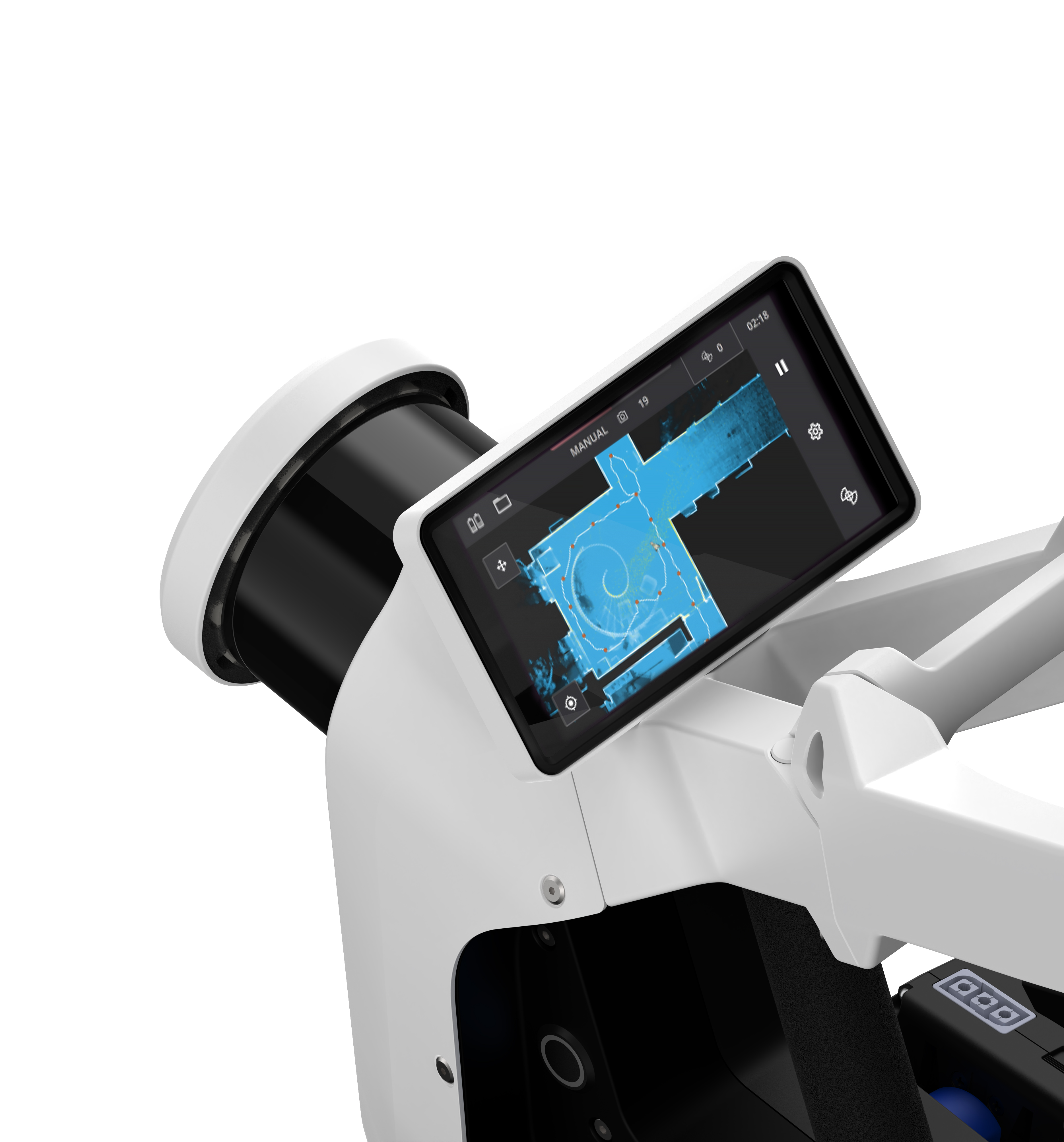


The Process
It's fast, accurate, detailed, easily accessible and sharable.
Create Deliverables
Immersive, user-friendly deliverables that are web-based and designed to ease workloads.
Learn MoreEasily Stored, Accessed, and Shared
Deliverables can be easily stored, accessed, and shared on a web-based platform.
Learn MoreHeritage Sites- Presivation
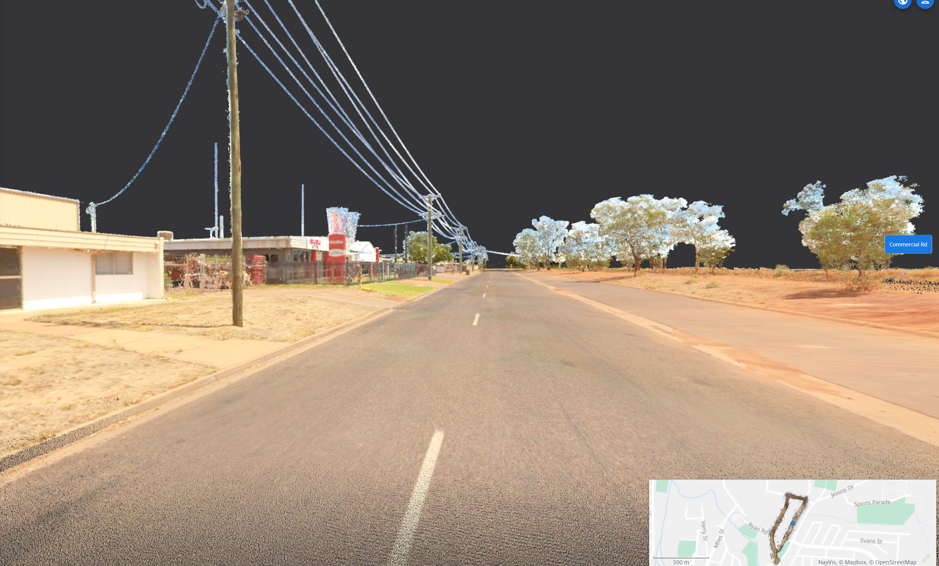
The Equipment used by Geoscan3D, produces a very fine and dense point cloud complete with embedded panorama images-ideal for preservation purposes
We can scan any site or building for heritage listing purposes.We are highly experianced in this field


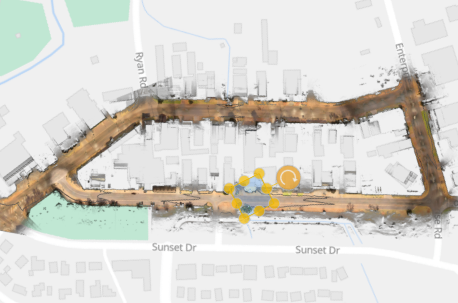
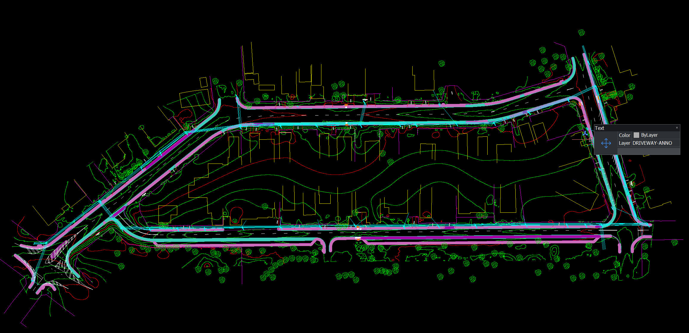
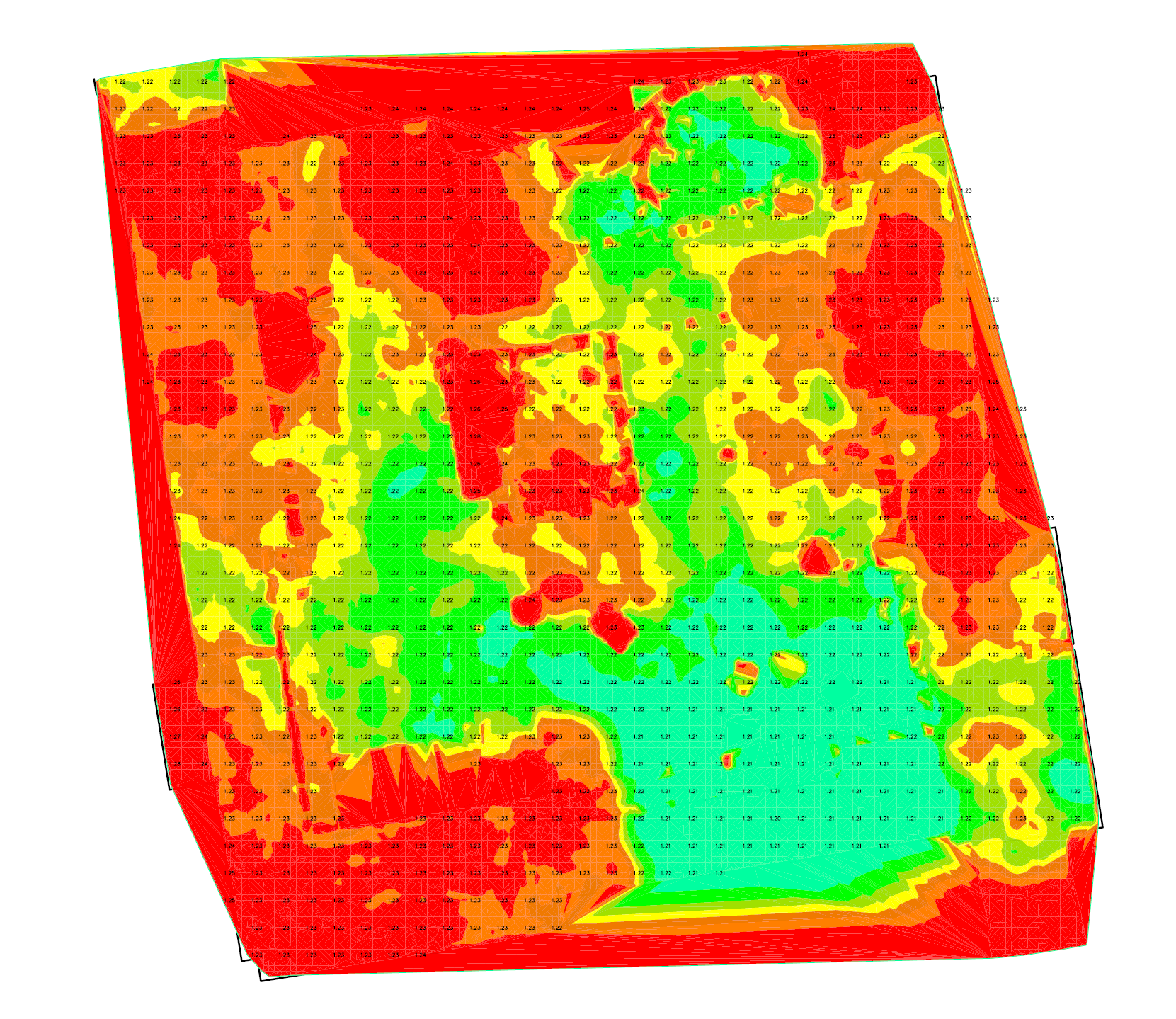
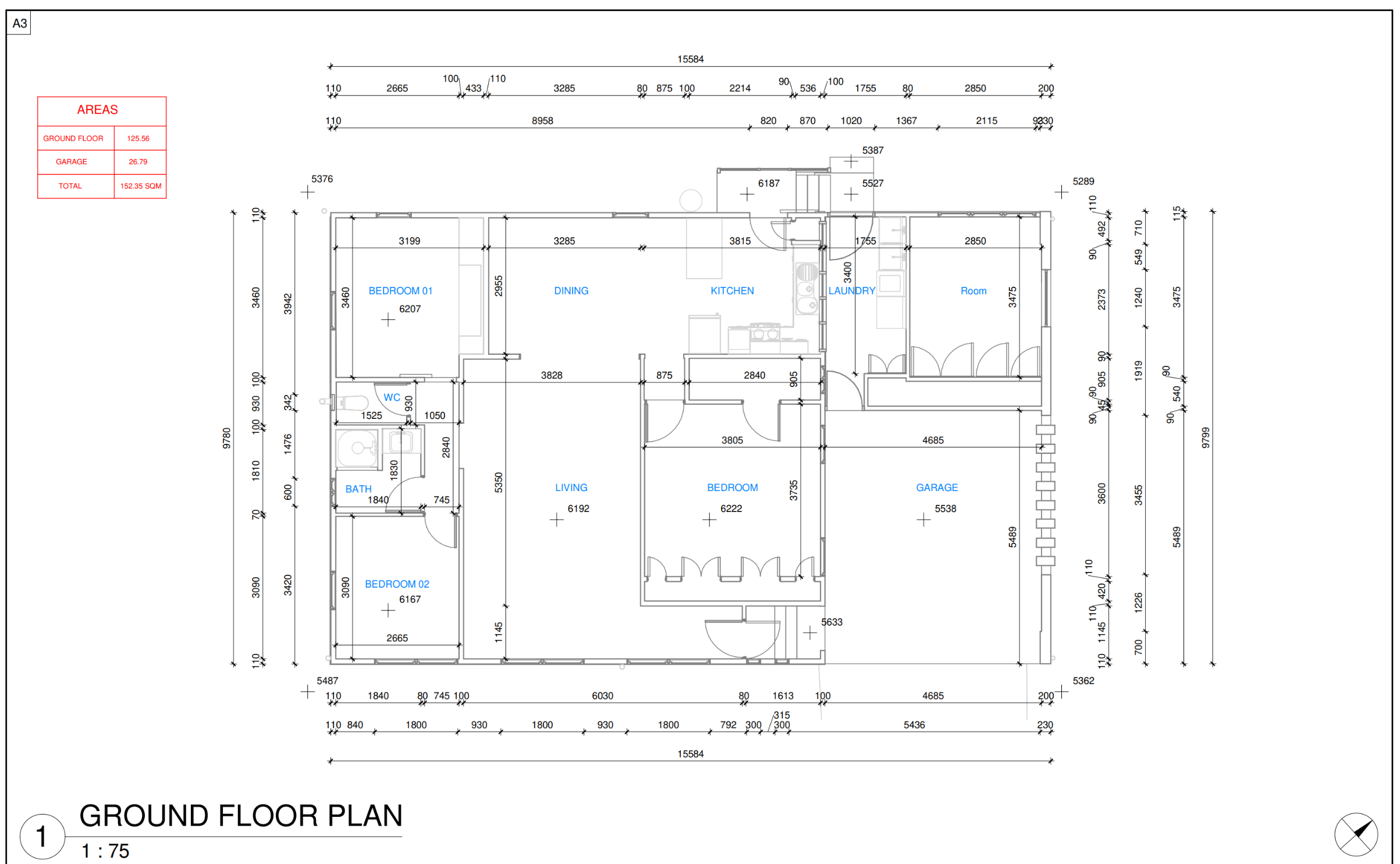
What Geo Scan 3D Creates
Geo Scan 3D creates state-of-the-art, highly detailed and complete digital twins, 3D models, 2D floor plans, Feature Extraction, asset tracking and , and topographical surveys.
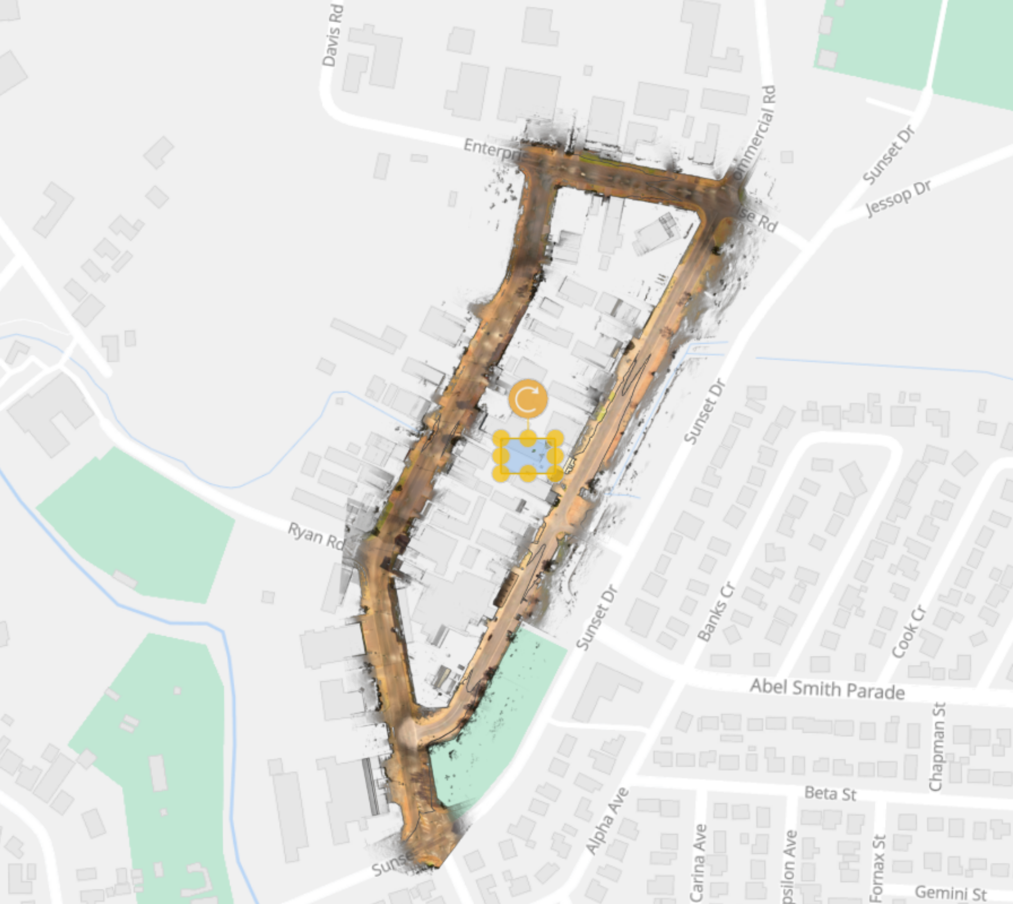
Scan-Commercial Place Mt Isa and feature extraction-Mt Isa Council
Industries we serve
Geo Scan 3D offers a trusted service to clients across various industries, including but not limited to:
- Local Government
- Mining Industry
- TAFE Colleges
- Health Care
- Indigenous Communities
- Ports
- Heratige Planning
- Architects
- Real Estate Agents
- Asset Managers
- Anthropology-Archaeology
- Emergency Services
- Shopping Centre Management
- Planners and Developers
Key Deliverables


Case Studies


Capability Statement