Mobile Scanning and Mapping Services Across Australia
Aurukun Shire Council
Aurukun, Queensland, Australia
Geo Scan 3D flew to the remote community of Aurukun, where they were engaged by the Aurukun Shire Council to scan and capture the entire community.
The scan and associated deliverables provided by Geo Scan 3D has given the Aurukun Shire Council access to the very latest technology, making things like quoting or RFQ simpler, and open to a wider market, due to people not having to travel to site for quoting. we also captured all the streets, one use being for planning of civile works such as kerb & guttering, that can be designed straight from the scan data.
Asett monitoring and condition assesmsnt was also a key component of the scope, we partner with Unganco for this deliverable due to their expertese in water asetts
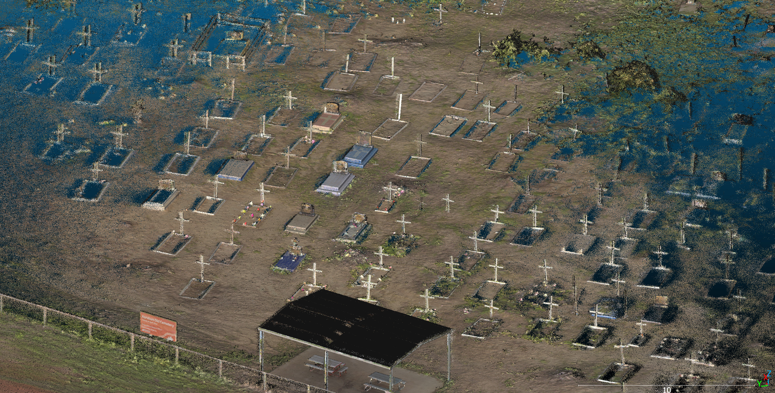
Another key deliverable required was to capture Sites of historical significance for geneology & social history purposes, provide a valuable source of information about local families,
Aurukun Shire can now view on a cloud based platform all community assets, indoor and outdoor spaces, to plan for future development, disaster planning, manage maintenance requirements and much more.